- PSSL has NICSI Empanelment for System Study, Design, Development, Implementation, Maintenance of Web
Portals, We Enabled Applications and Website.
- PSSL has NICSI Empanelment for Engagement of Technical Resources for Design, Development,
Maintenance& Administration of GIS and Remote Sensing Projects
- PSSL has BECIL Empanelment for SITC in the Field of Drone Technology and related Tools and Infrastructure.
- PSSL has Global Tie-ups with different Industry Leaders of Drone & Anti-Drone and GIS OEMs.
Project (1)- Airport Authority of India :-
The Department consists of Statisticians and Airport Management
Executives with field representatives at major airports for on-site compilation of correct information. AAI has
developed an application named “NOCAS”, which is based on ESRI’s GIS technology. All parameters, including the
height of the buildings, are important as no building should come in the flight path of aircrafts. To verify the claims of
the applicants, AAI has decided to survey the sites applying for the No Objection Certificate.
We have maintained the process through dedicated GIS team members, that will go to the specified site, Survey the
Site/building in question (Using DGPS / ETS) and will create the site plan, along with other details like height etc.,
upload the same into the system. All the resources deployed on this project have gone through a rigorous
Professional Training program of DGPS (Differential Global Positioning System), ETS (Electronic Total Station), Arc
GIS etc. for 15 days.
Project (2)- Election Commission of India :-
EVM Management System is designed to manage the inventory of EVM
Units. It helps us in real-time tracking of units. It also keeps analysing the results of units as regulated by EC. The
EVM Management System has two components, the first is a Web-based application and the second is a mobile
application. Our Dedicated Professionals have been developing and maintaining the project: -
- Web-Based Application is the main application that will be having core functionalities related to the EVM business
process and will be used by users like Manufacturer, ECI, CEOs, DEOs, Warehouse In-charge, etc. Role-Based access
will be provided to different users at the same URL
- Mobile Application is a supporting application that will be used by temporary users for mainly scanning at
warehouse level during sending and receiving EVM units, receiving in Assembly Constituency after 1st
randomization, etc. It is meant for the immediate replacement of EVM on polling booths.
Project (3)- RajCOMP Info Services Ltd :-
PSSL has been awarded the “Project for specialized manpower for
checking and validation of Data submitted by the System Integrator in the 3D City Project”.
The specialized manpower being deployed by the selected agency, will work under the supervision of RISL/
DoIT&C/ Concerned Departments. Anytime during the tenure of the work order, the Successful bidder (s) may be
required to undertake various project activities under different deliverables of work / service as defined in the RFP
but not limited to, the following:
- Mobile / Terrestrial Data – LiDAR datasets - Precise Mobile and Terrestrial LiDAR datasets have been acquired as
part of the project. The selected agency shall deploy experts to check on the LiDAR datasets and make effective
use of these datasets for the benefits of project and also suggest in utilization of same for other initiatives
- PanoPhoto data from Mobile LiDAR System - During data acquisition activity, along with the LiDAR datasets
360 Degree Pano-photo data was also captured. This dataset is critical for 3D City Model generation as well as
validation of city furniture. The team deployed from the selected agency shall make extension use of this dataset
for checking and validation of the data being submitted by the SI team..
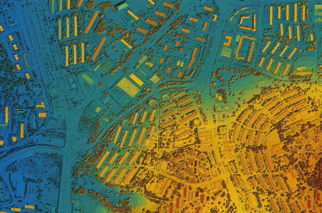
- Digital Elevation Models (DTM, DSM & Contours) - The selected bidder is required to deploy skilled resources
to validate the Digital Elevation Model (DEM including DSM, DTM & Contours) as submitted by the SI. The
resource shall check if the respective datasets and GCP information is rightly incorporated in the deliverables
being submitted by the SI along with necessary metadata information and defined quality standards in the RFP.
- Other Intermediate Products (True Ortho Mosaic Image, 3D Mesh Model, 3D Base Map, 3D LULC Map, etc.) As
per the deliverables defined in the RFP, the SI is required to generate mentioned intermediate products which
may be used along with the 3D City Models or independently.
- True-Ortho Mosaic
- 3D Mesh Model
- 3D Base Map
- s3D LULC Map
- Various 3D City Models of Level of Definition LoD0, LoD1, LoD2, LoD2.5, LoD3, LoD4 & LoD5
- 3D city models are typically constructed at various Levels of Details (LOD) to provide notions of multiple
resolutions at different levels of abstraction
- Reporting and documentation mechanism
- Testing and Validation of datasets on the 3D City Platform
- Training and Capacity Building of in-house resources

